
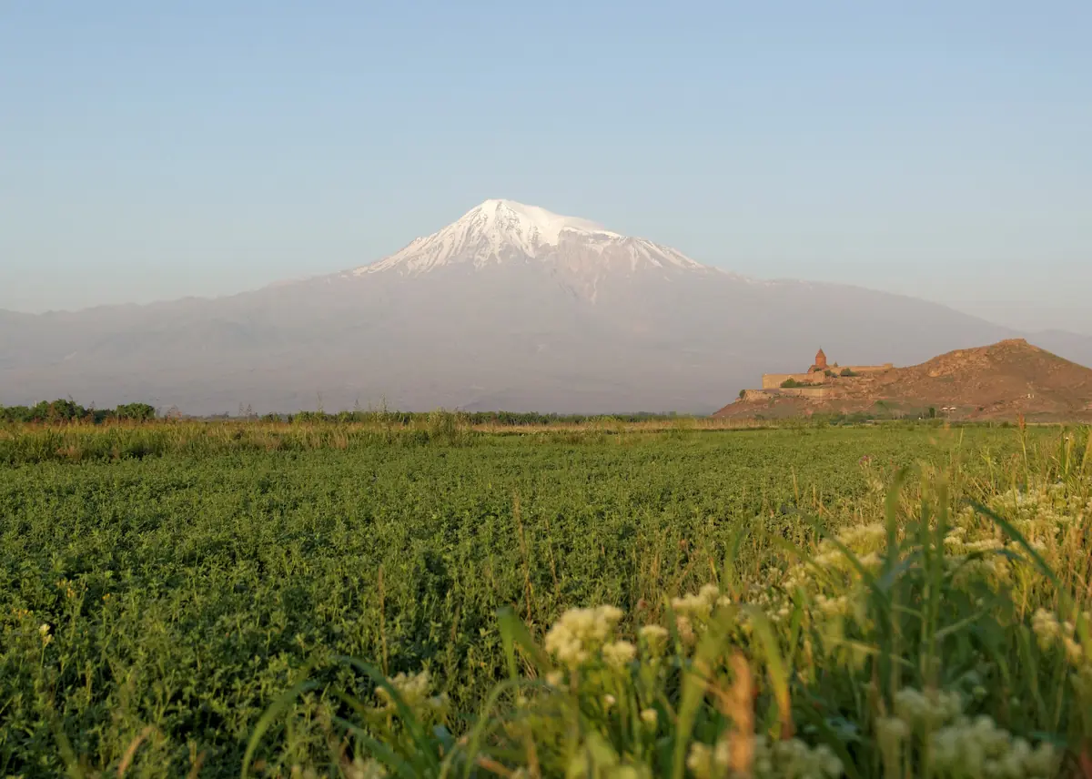
Mount Ararat (Ağrı Dağı in Turkish, Masis in Armenian) is the highest peak in Turkey: 5,137 metres, in the far east of the country, near the borders with Armenia and Iran. Since the Middle Ages it has been identified as the place where Noah's Ark came to rest, following Genesis: "the ark rested … upon the mountains of Ararat" (Genesis 8:4).
Expeditions have searched its icy summit, then a strange boat-shaped formation 29 km to the south, the Durupınar site. In 2026, with the permission of the Turkish authorities, an international team carried out the first deep drilling there. As of 29 September 2026, the answer to the question "has Noah's Ark been found?" remains the same: no remains of the ark have been authenticated. Laboratory results are expected in winter 2026-2027.
Mount Ararat, a Volcano on the Edge of Turkey
- Elevation5,137 m (Greater Ararat) and 3,896 m (Lesser Ararat)
- TypeDormant volcano with two cones
- Last eruption2 July 1840
- First known ascent9 October 1829
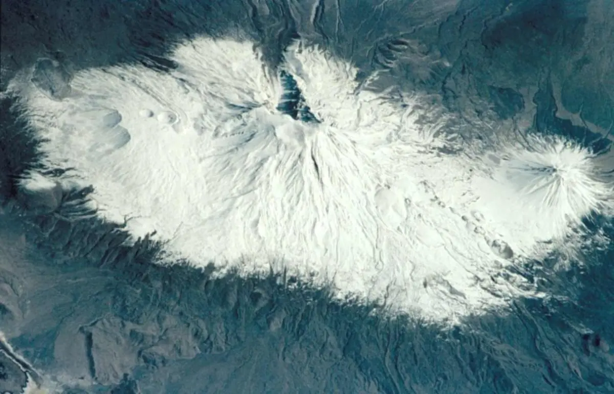
Ararat is a volcano made up of two cones: Greater Ararat, covered by an ice cap, and Lesser Ararat, to the south-east. It rises between the Turkish provinces of Ağrı and Iğdır, almost at the meeting point of Turkey, Iran, Armenia and the Azerbaijani exclave of Nakhchivan. Its last eruption, on 2 July 1840, came with a violent earthquake: a landslide buried the Armenian village of Akhuri and the monastery of St Hakob (St James), on the northern slope.
The first known ascent dates from 9 October 1829, when the naturalist Friedrich Parrot and the Armenian writer Khachatur Abovian reached the summit. Since 2004, the mountain has been protected as a Turkish national park.
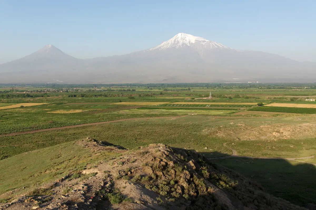
The mountain remains a symbol for Armenians: it dominates the skyline of Yerevan, some sixty kilometres away, and appears with the ark on the coat of arms of Armenia, even though it has been in Turkey since 1921.
"The Mountains of Ararat": What the Bible Says
The Flood story (Genesis 6–9) does not name a peak but a region. After a hundred and fifty days, the waters go down and the ark comes to rest:
"And the ark rested in the seventh month, on the seventeenth day of the month, upon the mountains of Ararat."
Genesis 8:4 (KJV)
וַתָּנַח הַתֵּבָה בַּחֹדֶשׁ הַשְּׁבִיעִי בְּשִׁבְעָה־עָשָׂר יוֹם לַחֹדֶשׁ עַל הָרֵי אֲרָרָט
בראשית ח, ד
Ararat is the biblical name of Urartu, a kingdom known from Assyrian texts, centred on Lake Van and powerful from the 9th to the 6th century BCE. Elsewhere the Bible mentions it as a country: after killing their father, the sons of Sennacherib "escaped into the land of Ararat" (2 Kings 19:37), and Jeremiah calls on "the kingdoms of Ararat, Minni, and Ashchenaz" against Babylon (Jeremiah 51:27). The text therefore speaks of a mountain range in this region, without saying which one.
Several Mountains for One Ark
In antiquity, the place was not fixed. The historian Flavius Josephus (1st century CE), quoting the Babylonian priest Berossus, reports that remains of the ark could still be seen "in Armenia, at the mountain of the Cordyaeans". The Aramaic translation of Onkelos renders Ararat as "the mountains of Kardu", and both Syriac tradition and the Quran (sura 11:44) place the ark on Mount Judi (Cudi Dağı), about 300 km south-west of Ararat. The identification of today's summit, the Masis of the Armenians, with Noah's mountain took hold from the 11th century onwards, and Western tradition adopted it.
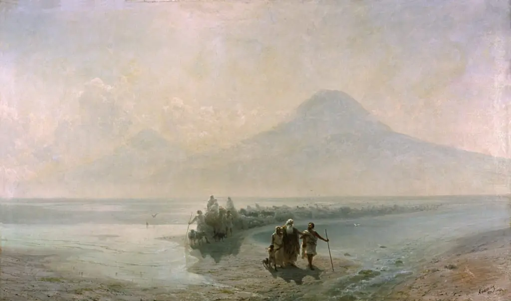
For the full story of the Flood and its Mesopotamian parallels (Atrahasis, Gilgamesh), see our page on the Origins, from Creation to Babel.
On the Summit: Two Centuries of Expeditions
The summit of Ararat, locked in ice and often closed to climbers for safety reasons, has fuelled more than a century of searches and announcements. None has stood up to scrutiny.
- 1876 — The British jurist James Bryce climbs Ararat and brings back a piece of wood found well above the tree line. He wonders whether it could come from the ark, without being able to prove it.
- 1949 — Aerial photographs taken by the US Air Force show a dark shape in the ice, at around 4,700 m on the north-west slope: the "Ararat anomaly". Declassified in 1995 at the request of the researcher Porcher Taylor, they have never allowed anything other than rock and ice to be identified.
- 1955 — The French explorer Fernand Navarra brings back an oak beam extracted from the ice. Radiocarbon-dated by several laboratories, it goes back roughly to the 7th–8th centuries CE: far too recent to be the ark. It may come from an old sanctuary built on the mountain.
- 1980s — The former astronaut James Irwin, who had walked on the Moon, leads several expeditions without result.
- 2010 — A Hong Kong evangelical group, Noah's Ark Ministries International, announces a wooden structure at around 4,000 m, dated to 4,800 years ago. A former partner in the project, the American archaeologist Randall Price, accuses local guides of planting wood; no scientific study has been published.
🧊 A geological obstacle
Ararat is a volcano that is active on a geological timescale, and its lava flows and glaciers constantly reshape its slopes. For geologists, a wooden object preserved on the summit for several millennia would be highly unlikely.
Durupınar, the Stone "Hull" 29 km from the Summit
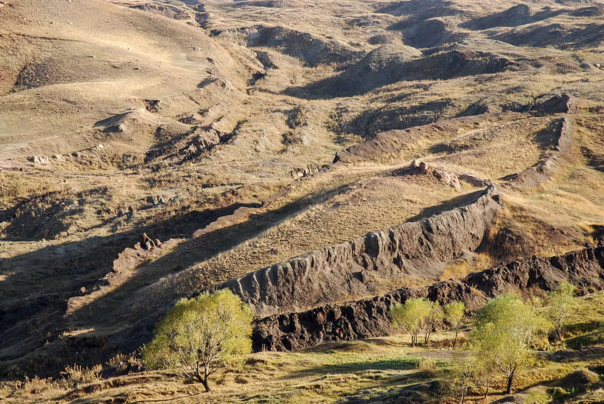
The Durupınar site lies near the village of Üzengili, some twenty kilometres south-east of Doğubayazıt, at an altitude of around 2,000 m and 29 km south of the summit. Seen from above, it is an elongated, hull-shaped mound about 160 m long. Its supporters measure it at 157 m, or 300 cubits if one takes the Egyptian royal cubit of 52.4 cm: the length given in Genesis 6:15.
- 1948 — After heavy rain and earth tremors, the shape appears on the slope. A Kurdish shepherd reports it.
- 1959 — Captain İlhan Durupınar of the Turkish army spots it on aerial photographs. It has borne his name ever since.
- 1960 — An American expedition, with the photogrammetry specialist Arthur Brandenberger, digs into the mound and concludes that it is a natural formation, with no archaeological remains.
- 1977-1990 — The American amateur archaeologist Ron Wyatt promotes it as the "real ark". The Turkish authorities designate the site and open a visitor centre there.
- 1996 — The geologist Lorence Collins and the explorer David Fasold, long associated with Wyatt, publish a study that describes the mound as a syncline: a natural fold in sedimentary rock, carved into a boat shape by erosion.
The site has never convinced geologists, whether they are believers or not. Even creationist researchers, who hold the Flood to be historical, consider Durupınar to be a natural formation.
The Latest Research (2019-2026)
In recent years, Durupınar has been the subject of a new programme of measurements. Three teams have followed one another, and their announcements have been widely reported. Here is what they have actually established.
Radar and Tomography (2019-2025)
An American group, Noah's Ark Scans, led by the independent researcher Andrew Jones, has been probing the mound with ground-penetrating radar and electrical resistivity tomography since 2019. In 2025, it announced right-angled structures down to a depth of 6 m, three levels that it interprets as decks, and a 13 m corridor in the centre. Andrew Jones acknowledged at the time: "Are we really facing something man-made, or is it an extraordinary natural formation? We need more data to understand this."
Soil Analyses (2023-2026)
In October 2023, a team from Ağrı İbrahim Çeçen University, Istanbul Technical University and Andrews University in the United States presented its analysis of some thirty samples: clay, marine deposits and mollusc remains. According to the team, they point to human activity in the region during the Chalcolithic, between 5500 and 3000 BCE. Its leader, Faruk Kaya, made clear that these results are not enough to prove the presence of the ark.
In April 2026, Noah's Ark Scans published a new study, with the Australian soil specialist Bill Crabtree and the Turkish geologist Mehmet Salih Bayraktutan: 88 samples taken at 22 points and analysed at Atatürk University in Erzurum. The soil inside the formation reportedly contains about three times more organic matter and 38% more potassium than the soil just outside it.
The 2026 Drilling
In June 2026, the Turkish authorities authorised a research programme led by the archaeologist Cenker Atila of Cumhuriyet University in Sivas, with Andrew Jones as vice-president. Around twenty researchers from five countries worked on the site for nearly 90 days, from late June to September:
- core drilling down to 18 m, inside and outside the formation, a first;
- nearly 1,000 soil samples taken at 150 points, with about 40% more carbon inside the formation;
- pottery fragments, whose age has not yet been measured;
- a drill bit that shattered at around 4 to 5 m on a material "harder than limestone", which the team presents as possible petrified wood, with no analysis at this stage.
Laboratory results are expected in winter 2026-2027, and Sivas University plans to publish a first volume, Durupınar Formation 2026 Research, in 2027.
⚠️ Where do things stand on 29 September 2026?
None of these studies has been published in a peer-reviewed scientific journal. No piece of wood, no nail, no structural element has been extracted and dated. Press reports headlined "Noah's Ark found" therefore go beyond what the researchers themselves have established.
Can the Ark Be Authenticated? Our Analysis
Authenticating the ark would require evidence of a different kind from what has been put forward so far:
- A dated building material: worked wood, joints, tool marks, dated by several independent laboratories.
- Ruling out natural causes: soil richer in carbon or potassium, or right-angled radar echoes, can have geological causes (folded layers, fractures, water trapped in a basin). These measurements do not, on their own, tell us what produced them.
- A verifiable publication: complete data, submitted to specialists who are not involved in the project.
It is also worth remembering that the Bible names neither Mount Ararat nor Durupınar: it speaks of "the mountains of Ararat", that is, a vast region. Even for a reader who takes the story as historical, nothing requires the ark to be sought in this precise spot. Geological research, for its part, has found no trace of a flood that covered the whole earth; it does, however, know of great floods in Mesopotamia, where the oldest flood stories were born.
The 2026 drilling has one merit: it is authorised, documented and announced with its limits. Its results deserve to be awaited before they are commented on. Whatever the outcome, the meaning of the story does not depend on a stone hull: Genesis makes it the story of a covenant between God and every living creature, from which Jewish tradition draws the seven Noahide laws. We will update this article as soon as the analyses are published.
Seeing Mount Ararat and the Durupınar Site
Mount Ararat is best planned as a trip of its own, in eastern Turkey. The town of Doğubayazıt (Ağrı province), at the foot of the mountain, is the starting point; it is also home to the İshak Pasha Palace, an 18th-century Ottoman palace perched above the plain.
- The Durupınar site is set up for visitors, with a visitor centre at Üzengili and a terrace overlooking the whole formation. You will need a car or a taxi from Doğubayazıt.
- Climbing to the summit requires a permit issued by the Turkish authorities, obtained through an approved agency, and a guide. The climb is usually done in summer, over four to five days, with a stretch across the ice cap near the summit. Check conditions and lead times with an agency before booking.
- From Armenia, the most famous view is from the monastery of Khor Virap, at the foot of the mountain. The land border between Armenia and Turkey is not open to travellers: you cannot cross from one to the other by road.
Turkey has another important biblical stop: Haran, near Şanlıurfa, where Abraham's family settled before Canaan (see our article on Abraham). According to the tradition recorded by Maimonides, Noah offered his sacrifice on leaving the ark on Mount Moriah, in Jerusalem, where the Temple was built. To visit the biblical sites of Israel, plan your itinerary with Create my tour.
Sources and references
- Genesis 6–9 and Genesis 8:4 (Hebrew text and translations on Sefaria)
- Flavius Josephus, Jewish Antiquities, I, 3, 5-6 (quoting Berossus)
- L. G. Collins and D. F. Fasold, "Bogus 'Noah's Ark' from Turkey Exposed as a Common Geologic Structure", Journal of Geoscience Education 44 (1996)
- Deseret News — "Why a group of researchers believe they found human activity near a possible Noah's Ark site", 31 October 2023
- The Jerusalem Post — "Durupinar radar scans reveal hidden structures linked to Noah's Ark", 15 May 2025
- Arkeonews — "Noah's Ark Mystery Deepens as New Discoveries Emerge Near Mount Ararat", 23 September 2026
- Noah's Ark Scans — press release "Core Drilling Begins at Durupinar Noah's Ark Site", 23 September 2026 (source from the project team)
- A. Judkins, "Durupinar Debunked: A Comprehensive Analysis Debunking the Claims of Noah's Ark at the Durupinar Site" (critical analysis)
- Christian Science Monitor — "Doubt cast on Noah's ark found in Turkey", 28 April 2010
Frequently asked questions
Has Noah's Ark been found?
No. As of 29 September 2026, no remains of the ark have been authenticated. The most recent research, at the Durupınar site in Turkey, has produced radar measurements, soil analyses and core samples whose laboratory results are expected in winter 2026-2027. None of it has been published in a peer-reviewed scientific journal.
Where is Mount Ararat?
In the far east of Turkey, between the provinces of Ağrı and Iğdır, near the borders with Armenia and Iran. The summit rises to 5,137 m. The nearest town for a visit is Doğubayazıt.
Does the Bible say the ark came to rest on Mount Ararat?
Not exactly. Genesis 8:4 speaks of "the mountains of Ararat", that is, a region: the Urartu of the Assyrian texts, around Lake Van. The identification with today's summit dates from the Middle Ages; other traditions, including the Quran, place the ark on Mount Judi, further south.
What is the Durupınar site?
A hull-shaped mound about 160 m long, 29 km south of Mount Ararat, near the village of Üzengili. Spotted in 1959 on aerial photographs, it is presented by some as the fossilised imprint of the ark. Geologists see it as a natural fold in the rock (a syncline) carved by erosion.
What did the 2026 drilling at Durupınar find?
The team led by Cenker Atila (Sivas University) drilled down to 18 m, took nearly 1,000 soil samples and collected undated pottery fragments. It reports more carbon inside the formation and a very hard material at a depth of around 4 to 5 m. None of these findings has yet been analysed or published.
Can you climb Mount Ararat?
Yes, with a permit issued by the Turkish authorities, obtained through an approved agency, and a guide. The climb is usually done in summer, over four to five days, starting from Doğubayazıt. Check how long the permit takes to obtain before booking.
Can you see Mount Ararat from Armenia?
Yes: the mountain dominates Yerevan and the Ararat plain. The best-known view is from the monastery of Khor Virap. As the land border between Armenia and Turkey is not open to travellers, you cannot reach the Turkish site from Armenia by road.
What is the "Ararat anomaly"?
A dark shape in the ice, at around 4,700 m on the north-west slope, photographed by the US Air Force in 1949 and declassified in 1995. No expedition or satellite image has shown anything there other than rock and ice.
Places related to this article
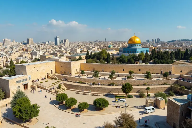
Mount Moriah: Abraham's Test, from the Biblical Story to the Temple Mount
Where tradition places Abraham's test now stands the Temple Mount, one of the holiest sites in Judaism and Islam.
Sodom and Gomorrah: the Cities of the Plain and the Valley of Siddim
From the Genesis narrative to the excavations at Bab edh-Dhra and Tall el-Hammam: what we know — and what we do not — about the cities destroyed near the Dead Sea.
Read next
Joseph and Imhotep: One and the Same Man?
The Famine Stela, the Saqqara galleries, the canal of Joseph: the theory that identifies the biblical Joseph with the sage Imhotep, its case and its limits.
An Assyrian Seal Found in Jerusalem Sheds Light on Judah and Assyria
A fragment of an Akkadian bulla found near the Western Wall: rare written evidence of relations between the Kingdom of Judah and the Assyrian Empire.