
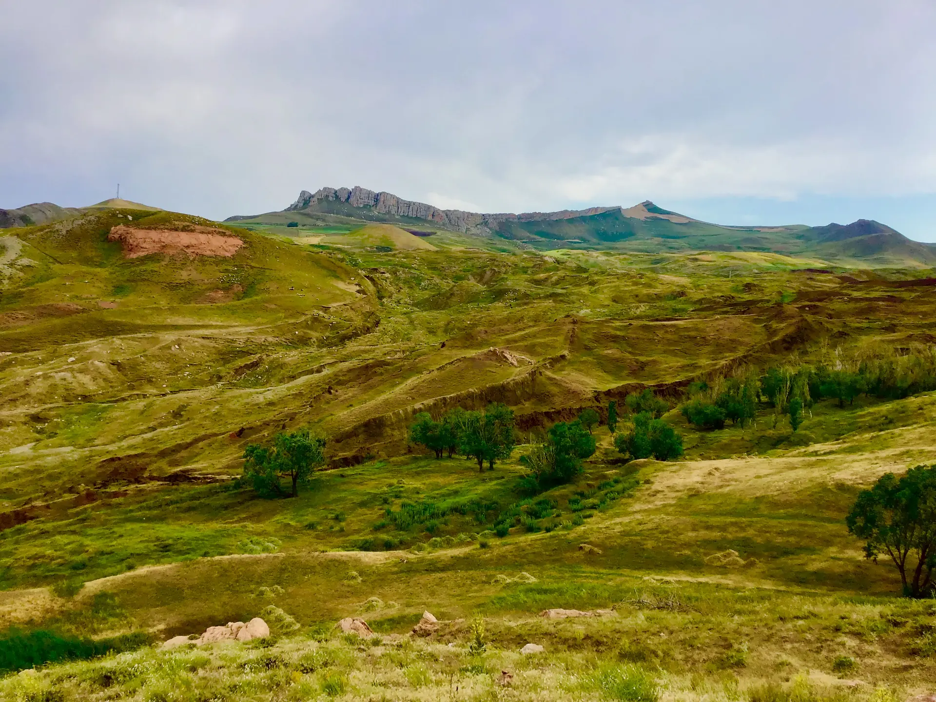
Since the summer of 2026, the name Noah's Ark Scans has been back in the news. This American group has spent several years studying the Durupınar site, a boat-shaped mound at the foot of Mount Ararat in eastern Turkey, which it considers a possible resting place of Noah's Ark. This year, together with a Turkish university, it carried out the first permitted core drilling there since the late 1980s.
At the end of September, several outlets ran the headline "Noah's Ark found". The project's own leaders corrected them. As of 30 September 2026, no remains of the ark have been identified, and laboratory results are expected in 2027. Here is where things stand, with sources.
- LocationDurupınar, near Üzengili (Ağrı province, Turkey)
- ProjectNoah's Ark Scans and Sivas Cumhuriyet University
- Field seasonSummer 2026, cores down to 18 m
- Results expectedWinter 2026-27 to summer 2027
What is the Noah's Ark Scans project?
Andrew Jones and the research team
Noah's Ark Scans is a California-based American group founded by Andrew Jones, a software developer who is not a trained archaeologist. Newsweek describes it as "an American Christian group". Its stated aim is to study the inside of the Durupınar formation without destroying it, first with geophysical surveys, then with drilling.
Since 2026 the group has worked within an official framework. The research programme is led by archaeologist Cenker Atila of Sivas Cumhuriyet University, with Andrew Jones as deputy head. According to Noah's Ark Scans, Dokuz Eylül University (İzmir) and Ağrı İbrahim Çeçen University are partners. The Turkish press reports that some twenty researchers from five countries took part in the season, followed by three film crews.
The project is funded by donations. By the end of September 2026, its online fundraiser had collected $104,000 of a $600,000 goal, according to Newsweek.
Durupınar, a boat-shaped formation in Turkey
 Doğubayazıt, Ağrı province (Turkey)Mount Ararat – Noah's Ark and the Durupınar SiteFor two centuries, explorers have searched for Noah's Ark on Mount Ararat and at its foot. In 2026, a team drilled the Durupınar site for the first time. Here is what we know, what remains to be proven, and how to see the mountain.View site →
The Durupınar site lies between the villages of Telçeker and Üzengili, about 16 km south-east of Doğubayazıt and 29 km south of the summit of Mount Ararat, at around 2,000 m above sea level. From above, it is a long, hull-shaped mound, about 157 to 165 m long depending on the source.
Turkish army captain İlhan Durupınar spotted it on aerial photographs in 1959, hence its name. An American expedition excavated it as early as 1960 and concluded it was a natural formation. From 1977, amateur archaeologist Ron Wyatt promoted it as the "real ark". In 1987 Turkey made it a protected site and opened a visitor point. The story of the mountain and its expeditions is told on our Mount Ararat page.
How are researchers exploring the site?
Ground-penetrating radar, electrical tomography and LiDAR
Noah's Ark Scans began with methods that do not dig into the ground. Ground-penetrating radar sends waves into the earth and records their echoes: a change of material sends back a signal. Electrical resistivity tomography measures how the subsoil resists an electric current: water, clay, rock and wood all respond differently. The group also mentions LiDAR surveys, a laser that maps the terrain to the centimetre.
The group says it carried out such surveys in 2014, 2019 and 2021. The radar work was entrusted to engineer Khosrow Bakhtar of the American firm Bakhtar Research and Engineering.
Core drilling to examine the subsoil directly
Remote measurements do not tell you what an echo is made of. To find out, you have to bring material up. In 2026 the team therefore took core samples: a tube driven into the ground brings up a cylinder of earth whose layers can be read. Drilling was done by percussion, without drilling fluid, so as not to contaminate the samples. One borehole reached 18 m, the others 5 to 8 m, both inside and outside the formation for comparison.
What evidence does the team put forward?
Anomalies interpreted as corridors and compartments
In 2025 Noah's Ark Scans presented radar images showing right-angled structures down to about 6 m, three stacked levels that the group interprets as a ship's decks, and a corridor running through the centre of the mound. Andrew Jones acknowledged at the time: "Is this really a man-made structure, or an extraordinary natural formation? We need more data to understand it."
Soil richer in organic matter
In 2024, soil samples analysed at Atatürk University in Erzurum showed, according to the team, about three times more organic matter and 38% more potassium inside the formation than outside. The group sees this as a possible trace of decayed wood. Earlier, in October 2023, a team from Istanbul Technical University and Ağrı University had identified clay, marine deposits and mollusc remains, and pointed to human activity in the Chalcolithic period. Its head, Faruk Kaya, stressed that this was not enough to say the ship was there.
Dimensions compared with the biblical account
Genesis gives the ark a length of 300 cubits, a width of 50 and a height of 30.
"The length of the ark shall be three hundred cubits, the breadth of it fifty cubits, and the height of it thirty cubits."
Genesis 6:15
Using the Egyptian royal cubit of 52.4 cm, 300 cubits come to 157 m, the length Noah's Ark Scans uses for the mound. But the cubit varied by period and region, and other measurements of the site give 164 or 165 m. The match therefore depends on the starting assumptions.
What did the 2026 research season bring?
- 21 May 2026 — The Erzurum regional office of Turkey's Ministry of Environment and Urbanisation approves the programme.
- Late June 2026 — Fieldwork begins, for about 90 days.
- 28 July 2026 — Cenker Atila officially presents the project to the Turkish press: radar, soil analysis and drilling "to search for wooden and skeletal remains".
- Around 22 September 2026 — Noah's Ark Scans announces the start of core drilling.
- 28 September 2026 — Both project leaders take stock and play down the headlines.
Samples taken and cavities reported
According to Cenker Atila, nearly 1,000 soil samples were taken from some 150 points, and pottery fragments were collected. He describes them as pre-Flood, but no dating has been done yet. Andrew Jones, for his part, speaks of more than 300 core samples sent to Ankara University laboratories. The two figures probably do not refer to the same samples.
The team also reports voids in the subsoil, between 3-4 m and about 13 m deep. A small robotic camera called GOPHER was lowered into the boreholes to film them; the second attempt reached about 12 m.
The petrified-wood hypothesis and the analyses to come
In one borehole inside the formation, at about 4 to 5 m, the drill bit broke on a very hard layer. Andrew Jones suggests it could be petrified or heavily mineralised wood, meaning wood whose fibres have been replaced by minerals. That is a possibility to be tested, not a result: the layer could just as well be rock. The laboratories must now measure organic matter, identify minerals and radiocarbon-date whatever can be dated.
📝 Figures that do not match
The Turkish press puts the end of fieldwork on 11 September, while Noah's Ark Scans describes drilling after 20 September. The number of researchers varies from 20 to 25 depending on the article. Such gaps are common in fast-moving news; the final report should clear them up.
Do these findings prove Noah's Ark is there?
No, not at this stage, and the researchers themselves say so. On 28 September 2026 Andrew Jones told Newsweek: "We have not identified any material as ancient wood or established its age." The same day, Cenker Atila told the Turkish daily Sözcü that the headlines "do not fully reflect accurate results at present", while adding: "Even though we have not yet reached 100% certainty, we have obtained astonishing data."
The limits of scans and field observations
A right-angled radar echo, soil richer in carbon or a cavity can all have natural causes: folded rock layers, fractures, pockets of water, plant debris collected in a hollow. The measurements show that there is something different under the mound; they do not say what. As for the pottery, without a precise position in a dated layer, it shows that people lived in the area, not that a ship was there.
The natural explanation offered by geological studies
The 1960 expedition dug into and dynamited part of the mound without finding any remains, and called it "a freak of nature". In 1996 geologist Lorence Collins and explorer David Fasold, who had long championed the site, published a study describing the mound as a syncline: a natural fold in rock layers, shaped into a boat form by erosion and mudflows. The "walls" picked up by detectors would be natural concentrations of iron minerals. In 2026 critics such as researcher Aaron Judkins repeat this reading and point out that no data has been submitted to a scientific journal.
Durupınar should not be confused with another famous claim: in 2010 an evangelical group from Hong Kong said it had found wood from the ark near the summit of Ararat. A former partner of that project, archaeologist Randall Price, accused local guides of bringing the wood to the site.
The evidence needed to identify an ancient ship
Before anyone can speak of a discovery, three conditions would have to be met:
- Construction material: worked wood, joints or tool marks, recovered from a well-defined layer.
- Independent dating: analyses by several laboratories that do not depend on the project.
- Verifiable publication: complete data, reviewed by outside specialists, that rules out geological explanations.
That is the yardstick for reading the 2027 results.
⚠️ Where do things stand on 30 September 2026?
No study from the project has been published in a peer-reviewed journal. No ancient wood, nail or building element has been identified or dated. "Noah's Ark found" headlines go beyond what the researchers themselves claim.
What does the Bible say about where the ark came to rest?
The "mountains of Ararat" in Genesis
"And the ark rested in the seventh month, on the seventeenth day of the month, upon the mountains of Ararat."
Genesis 8:4
וַתָּנַח הַתֵּבָה בַּחֹדֶשׁ הַשְּׁבִיעִי בְּשִׁבְעָה־עָשָׂר יוֹם לַחֹדֶשׁ עַל הָרֵי אֲרָרָט
בראשית ח, ד
The Hebrew text says harei Ararat, "the mountains of Ararat", in the plural. Ararat is the name of a country, the Urartu of Assyrian inscriptions, a kingdom that stretched around Lake Van, across today's eastern Turkey, Armenia and Iran. The Flood story and its place in the opening chapters of Genesis are covered on our The Origins page.
Why the text does not point to Durupınar
Genesis names neither a peak nor a specific spot: it places the ark's landing in a mountainous region. The mountain now called Ararat received that name fairly late; in Turkish it is Ağrı Dağı. Ancient traditions do not agree either: the Aramaic translation of Onkelos, the Syriac tradition and the Quran (sura 11:44) place the ark on Mount Judi, further south. Even for a reader who takes the account as history, nothing requires looking for the ark at Durupınar rather than elsewhere.
Whatever the analyses show, the meaning of the story does not depend on a stone hull: Genesis makes it the story of a covenant between God and every living creature, sealed by the rainbow, from which Jewish tradition draws the seven Noahide laws.
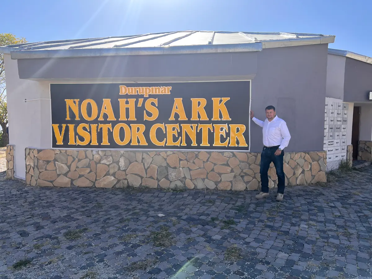
The formation can be seen from the terrace of the Üzengili visitor centre, about 16 km from Doğubayazıt. To explore the biblical sites of Israel, build your itinerary with our Plan my tour planner.
Sources and references
- Newsweek (J. King) — "Noah's Ark hunters say they haven't found ancient wood yet", 28 September 2026
- Newsweek (J. Bickerton) — "Noah's Ark hunters raise $100,000 as burglary detailed", 27 September 2026
- Sözcü — interview with Prof. Cenker Atila, 28 September 2026 (in Turkish)
- Daily Sabah — "Türkiye's Noah's Ark site shows higher organic matter in soil tests", 28 September 2026
- CNN Türk / İHA — launch of the research project, 28 July 2026 (in Turkish)
- Noah's Ark Scans — press release "Core Drilling Begins at Durupinar Noah's Ark Site", 23 September 2026 (project team source)
- The Jerusalem Post — "Durupinar radar scans reveal hidden structures linked to Noah's Ark", 15 May 2025
- Hürriyet / DHA — first results from Istanbul Technical University, 26 October 2023 (in Turkish)
- L. G. Collins and D. F. Fasold, "Bogus 'Noah's Ark' from Turkey Exposed as a Common Geologic Structure", Journal of Geoscience Education 44 (1996)
- A. Judkins, "A Public Statement on the Noah's Ark" (critical analysis), 28 September 2026
- Christian Science Monitor — "Doubt cast on Noah's ark found in Turkey", 28 April 2010
- Genesis 6:15 and 8:4 (Hebrew text and translations on Sefaria)
Frequently asked questions about Noah's Ark Scans
Has Noah's Ark been found?
No. As of 30 September 2026, no remains of the ark have been authenticated. The Noah's Ark Scans project has produced radar surveys, soil analyses and core samples at the Durupınar site in Turkey, but its leaders themselves state that no ancient wood has been identified or dated.
Has ancient wood been identified at Durupınar?
No. A drill bit broke at about 4 to 5 m on a very hard layer, which Andrew Jones presents as possible petrified wood. On 28 September 2026 he said: "We have not identified any material as ancient wood or established its age." Laboratory analyses will have to decide.
When will the lab results be available?
Cenker Atila expects radiocarbon dates within two to three months. Noah's Ark Scans expects first results over the winter of 2026-27 and a full report in spring or early summer 2027. Sivas University is also preparing a book, Durupınar Formation 2026 Research. We will update this article when they are published.
Who funds Noah's Ark Scans?
The project is funded by private donations, including an online fundraiser that had raised $104,000 of a $600,000 goal by the end of September 2026, and by merchandise sales. The 2026 research is led by Sivas Cumhuriyet University under a permit from the Turkish authorities.
Where is the Durupınar site?
In eastern Turkey, between the villages of Telçeker and Üzengili, about 16 km south-east of Doğubayazıt (Ağrı province) and 29 km south of the summit of Mount Ararat. A visitor centre with a terrace overlooks the formation. More on our Mount Ararat page.
Why do geologists think Durupınar is natural?
As early as 1960, an expedition that excavated the mound found no remains. In 1996 a study by geologist Lorence Collins and explorer David Fasold described it as a syncline, a natural fold of rock shaped by erosion. In their view, the regular shapes seen on radar come from geology, not construction.
Places to visit
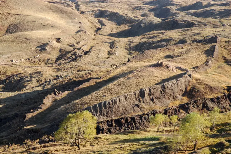
Mount Ararat – Noah's Ark and the Durupınar Site
For two centuries, explorers have searched for Noah's Ark on Mount Ararat and at its foot. In 2026, a team drilled the Durupınar site for the first time. Here is what we know, what remains to be proven, and how to see the mountain.
Read next
Joseph and Imhotep: One and the Same Man?
The Famine Stela, the Saqqara galleries, the canal of Joseph: the theory that identifies the biblical Joseph with the sage Imhotep, its case and its limits.
An Assyrian Seal Found in Jerusalem Sheds Light on Judah and Assyria
A fragment of an Akkadian bulla found near the Western Wall: rare written evidence of relations between the Kingdom of Judah and the Assyrian Empire.