
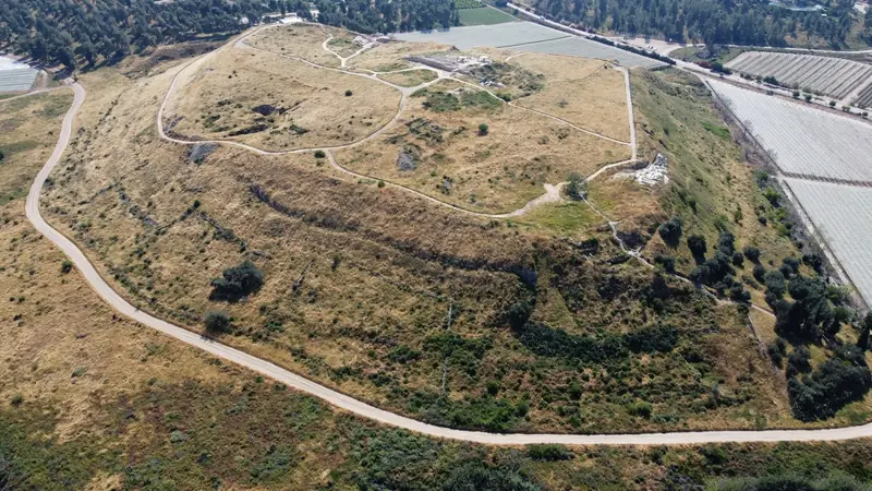
Tel Lachish: The Canaanite City Taken by Joshua
A royal Canaanite city under Egyptian rule, Lachish is one of the southern cities Joshua is said to have taken. Its excavations tell a more complex, and longer, story.
1500–1200 BCE
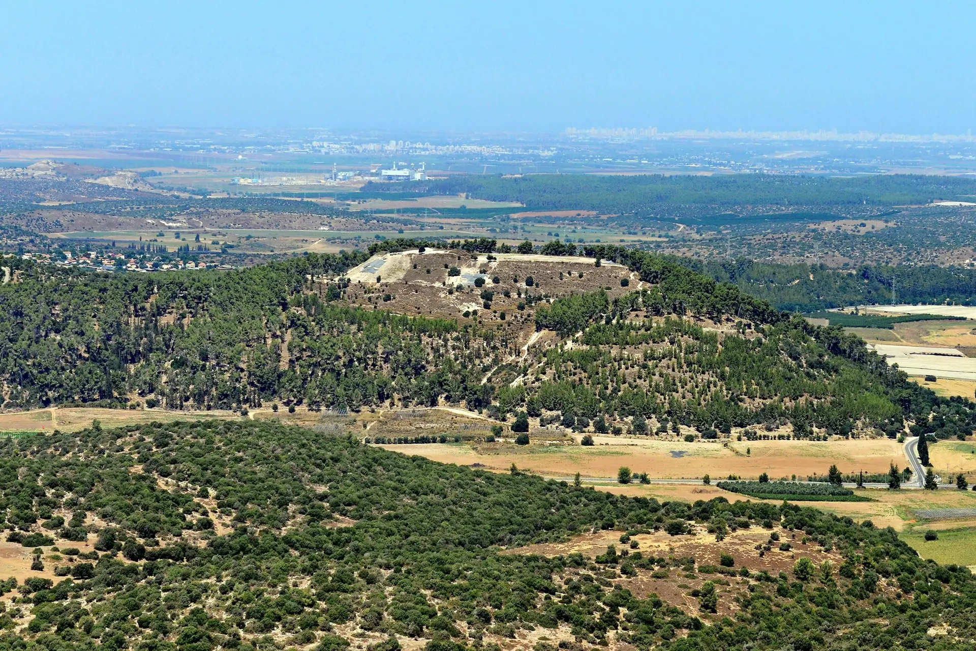
On a wooded hill commanding the Valley of Elah, Azekah marks the end of the pursuit of the Amorite kings. Excavations there have revealed a Canaanite city destroyed by fire.
Credit: AVRAMGR · CC BY-SA 4.0 · Wikimedia Commons
Tel Azekah (Azeka, Tell Zakariya in Arabic) overlooks the Valley of Elah, in the heart of the Judean Shephelah, inside Britannia Park, which is managed by KKL-JNF. The Book of Joshua ends the pursuit of the five Amorite kings here after the battle of Gibeon: the LORD casts down great hailstones from heaven "unto Azekah" (Joshua 10:10-11).
Since 2012, the Lautenschläger Azekah Expedition has uncovered a Late Bronze Age Canaanite city, with a temple and several victims, destroyed by fire in the second half of the 12th century BCE. Today the site is above all a lookout and a place to walk: from here you can read Joshua, David and Goliath and the last days of the kingdom of Judah in the landscape.
Five Amorite kings, those of Jerusalem, Hebron, Jarmuth, Lachish and Eglon, besiege Gibeon, Israel's ally. Joshua marches up from Gilgal all night, surprises the coalition and puts it to flight. The text follows the retreat of the defeated armies from Gibeon, by the ascent of Beth-horon, down to the hills of the Shephelah.
"And the LORD discomfited them before Israel, and slew them with a great slaughter at Gibeon; and they chased them by the way of the ascent of Beth-horon, and smote them to Azekah, and unto Makkedah. And it came to pass, as they fled from before Israel, while they were at the descent of Beth-horon, that the LORD cast down great stones from heaven upon them unto Azekah, and they died; they were more who died with the hailstones than they whom the children of Israel slew with the sword."
Joshua 10:10-11 (JPS 1917)
וַיְהֻמֵּם יְהוָה לִפְנֵי יִשְׂרָאֵל וַיַּכֵּם מַכָּה־גְדוֹלָה בְּגִבְעוֹן וַיִּרְדְּפֵם דֶּרֶךְ מַעֲלֵה בֵית־חוֹרֹן וַיַּכֵּם עַד־עֲזֵקָה וְעַד־מַקֵּדָה. וַיְהִי בְּנֻסָם מִפְּנֵי יִשְׂרָאֵל הֵם בְּמוֹרַד בֵּית־חוֹרֹן וַיהוָה הִשְׁלִיךְ עֲלֵיהֶם אֲבָנִים גְּדֹלוֹת מִן־הַשָּׁמַיִם עַד־עֲזֵקָה וַיָּמֻתוּ רַבִּים אֲשֶׁר־מֵתוּ בְּאַבְנֵי הַבָּרָד מֵאֲשֶׁר הָרְגוּ בְּנֵי יִשְׂרָאֵל בֶּחָרֶב
יהושע י, י-יא
Here Azekah serves as a geographical marker: the furthest point of the rout, where the hills of Benjamin give way to the Shephelah. The text does not say that the town itself was attacked or taken.
It is on the same day that Joshua speaks his famous words: "Sun, stand thou still upon Gibeon; and thou, Moon, in the valley of Aijalon" (Joshua 10:12-13). The account quotes the "book of Jashar", a lost collection of poetry, as its source. The valley of Aijalon and Gibeon lie some twenty and thirty kilometres north and north-east of Azekah: you cannot see that setting from the mound, but you do see where the pursuit ended.
In the list of the towns of Judah, Azekah appears among those of the lowland, alongside Jarmuth, Adullam and Socoh (Joshua 15:35). The same names cluster around the Valley of Elah, which helps to locate the site.
🔎 A secure identification
The mound, known as Tell Zakariya in the 19th century, has been identified with Azekah since that century. The identification rests mainly on biblical geography (nearby Socoh and the Valley of Elah, Lachish further south) and on the scale of its fortifications; it is now widely accepted.
Tel Azekah was one of the very first sites excavated in the Holy Land: in 1898–1899, Frederick J. Bliss and R. A. Stewart Macalister, working for the Palestine Exploration Fund, uncovered a fortress, towers and caves there, then backfilled their trenches. A century later the site was thought to be exhausted. In 2012 the Lautenschläger Azekah Expedition began, led by Oded Lipschits and Yuval Gadot (Tel Aviv University) and Manfred Oeming (Heidelberg University), with Ido Koch and Sabine Kleiman among others. Volunteers from around the world join the dig every summer.
Already fortified in the Middle Bronze Age, Azekah was a wealthy city in the Late Bronze Age, linked to the Egyptian administration that then controlled Canaan: scarabs, amulets and Egyptian objects are plentiful. Radiocarbon dates show that occupation continued into the 12th century BCE, after the crisis that struck the eastern Mediterranean around 1200.
On the eastern edge of the mound, facing the Valley of Elah, the excavators uncovered a Canaanite temple. In the 13th century BCE it was an open-air sanctuary oriented towards the sunrise, with a large round plastered altar and its basin next to a limestone pillar. In the 12th century it became an enclosed, roofed building with a symmetrical plan; its foundations contained seven "lamp-and-bowl" ritual deposits. Finds include a small bronze figurine of a god, probably Baal, a faience statuette of the Egyptian god Bes and an Egyptian amulet.
In the second half of the 12th century BCE the city was destroyed by fire. In a large building, four people were found crushed beneath the debris, in positions that point to a sudden catastrophe; in the temple, the remains of five men lay under the collapsed walls. The excavators date this destruction to around 1130 BCE or slightly later, and attribute it to no known aggressor.
In 2019 a complete jar bearing a few words in hieratic, the cursive script of Egyptian scribes, was found in this destruction layer. Published in 2026 in the journal Tel Aviv, the inscription probably refers to an official in charge of tax deliveries; clay analysis shows that the jar was made at Tell es-Safi/Gath, about 8 km to the west. It is so far the latest dated hieratic text from the southern Levant: the Egyptian administration was still working in the region shortly before the city fell.
⚖️ And Joshua?
The destruction of Canaanite Azekah dates to after 1200 BCE, well after the dates usually proposed for Joshua (around 1400 or in the 13th century). The biblical text, for its part, does not describe the town being taken. Nothing therefore links these victims to the account of Joshua 10; Egypt's withdrawal, rivalries between cities or the rise of nearby Philistine Gath are among the hypotheses considered.
Azekah remains a key name in biblical history long after Joshua's time; these episodes belong to the period of Judges and Kings.
It is between Socoh and Azekah that the Philistines pitch their camp before David's fight with Goliath.
"Now the Philistines gathered together their armies to battle, and they were gathered together at Socoh, which belongeth to Judah, and pitched between Socoh and Azekah, in Ephes-dammim."
1 Samuel 17:1 (JPS 1917)
וַיַּאַסְפוּ פְלִשְׁתִּים אֶת־מַחֲנֵיהֶם לַמִּלְחָמָה וַיֵּאָסְפוּ שֹׂכֹה אֲשֶׁר לִיהוּדָה וַיַּחֲנוּ בֵּין־שׂוֹכֹה וּבֵין־עֲזֵקָה בְּאֶפֶס דַּמִּים
שמואל א יז, א
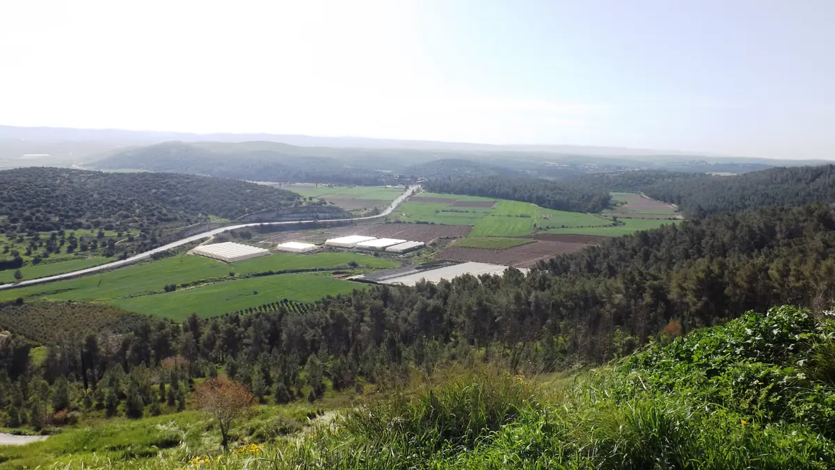
Resettled in the Iron Age, Azekah became a border town of the kingdom of Judah. A fragmentary Assyrian tablet in the British Museum, known as the "Azekah Inscription", describes its capture, often attributed to Sennacherib's campaign of 701 BCE: a town perched "on a mountain ridge" whose walls seemed to reach the sky.
During the Babylonian invasion, Jeremiah notes that Lachish and Azekah are the last fortified cities of Judah.
"When the king of Babylon's army fought against Jerusalem, and against all the cities of Judah that were left, against Lachish and against Azekah; for these alone remained of the cities of Judah as fortified cities."
Jeremiah 34:7 (JPS 1917)
וְחֵיל מֶלֶךְ־בָּבֶל נִלְחָמִים עַל־יְרוּשָׁלִַם וְעַל כָּל־עָרֵי יְהוּדָה הַנּוֹתָרוֹת אֶל־לָכִישׁ וְאֶל־עֲזֵקָה כִּי הֵנָּה נִשְׁאֲרוּ בְּעָרֵי יְהוּדָה עָרֵי מִבְצָר
ירמיהו לד, ז
An ostracon found at Lachish, Letter 4, ends: "we are watching for the signals of Lachish according to all the signs which my lord has given, for we cannot see Azekah". Some read it as the fall of Azekah; others think the writer, posted elsewhere, simply could not see it. Its echo of Jeremiah 34:7 remains one of the most striking meeting points between the biblical text and archaeology.
The mound stands on the northern edge of Britannia Park, a large area of planted and natural woodland managed by KKL-JNF (Keren Kayemeth LeIsrael). A picnic area lies at the foot of the hill; a short footpath, about a two-minute climb according to KKL-JNF, leads to the summit.
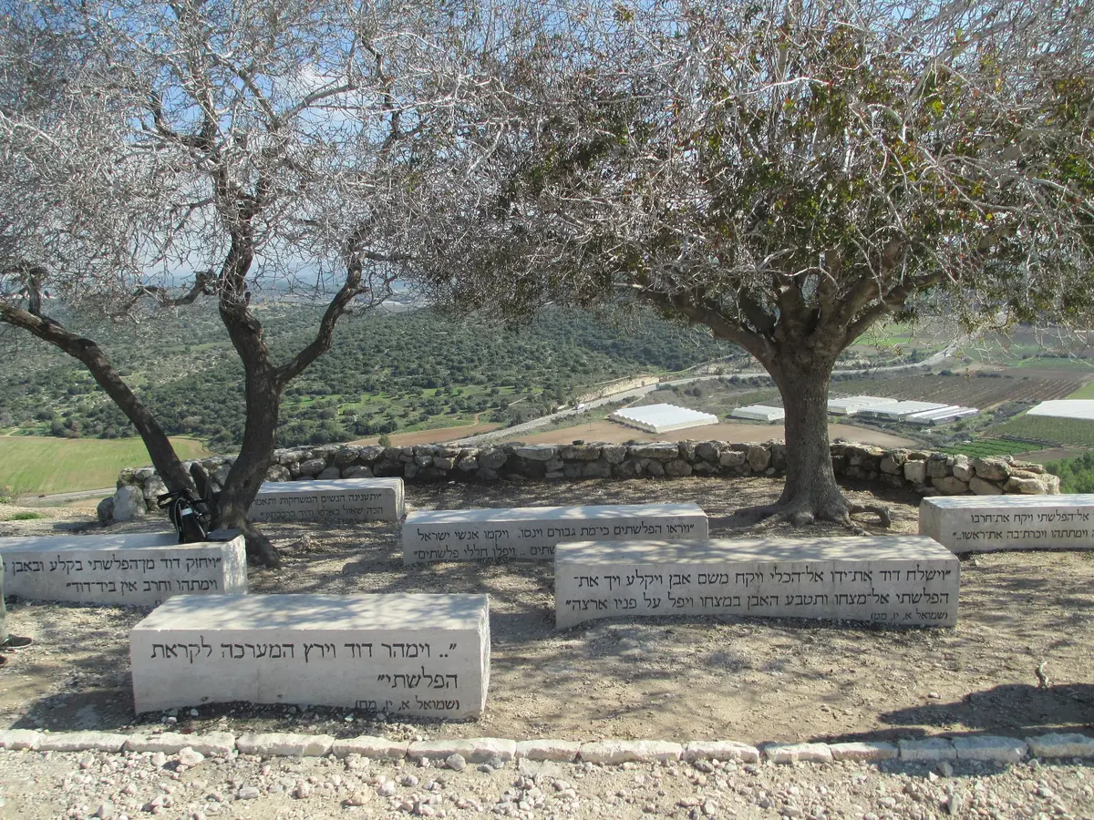
At the top, stone benches engraved with verses from 1 Samuel 17 face the Valley of Elah. To the east you follow the valley where tradition places the fight between David and Goliath; to the west, on clear days, you can make out Tel Tsafit (Philistine Gath) and the coastal plain. It is the best place to picture the geography of Joshua 10: a frontier between the hills and the plain.
The excavation areas cover several parts of the summit. They are not necessarily open or signposted for the public, and may be fenced or covered between seasons. The remains visible on the summit also belong to many periods, down to a fortress of the Hellenistic or Hasmonean period. To see work in progress, the easiest option is to come during the expedition's summer season and follow the team's instructions.
Tel Azekah: The Pursuit of the Amorite Kings (Joshua 10)
Tel Azekah, Britannia Park (KKL-JNF), near Moshav Zekharia, about 8 km south-west of Beit Shemesh
GPS coordinates : 31.6992, 34.9359
Start navigation with:
A royal Canaanite city under Egyptian rule, Lachish is one of the southern cities Joshua is said to have taken. Its excavations tell a more complex, and longer, story.
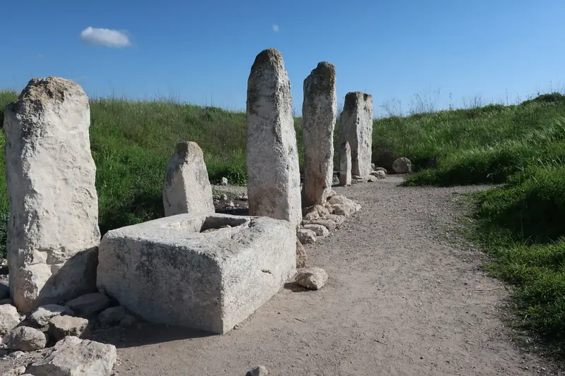
A powerful Canaanite city that the Book of Joshua says was never taken, named by the pharaohs of the Amarna age and by Merneptah, then rebuilt under Solomon.
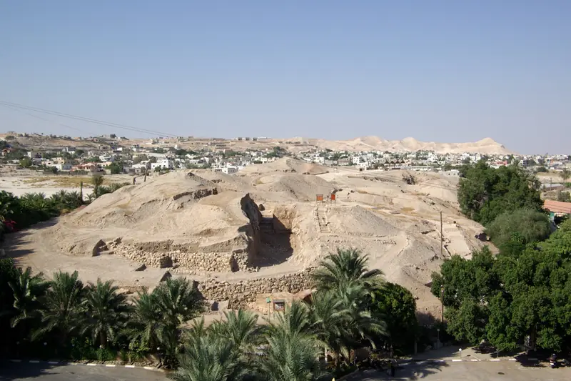
Rahab, the Jordan crossing and the falling walls: the Book of Joshua set against a century of excavation at one of the oldest towns in the world.
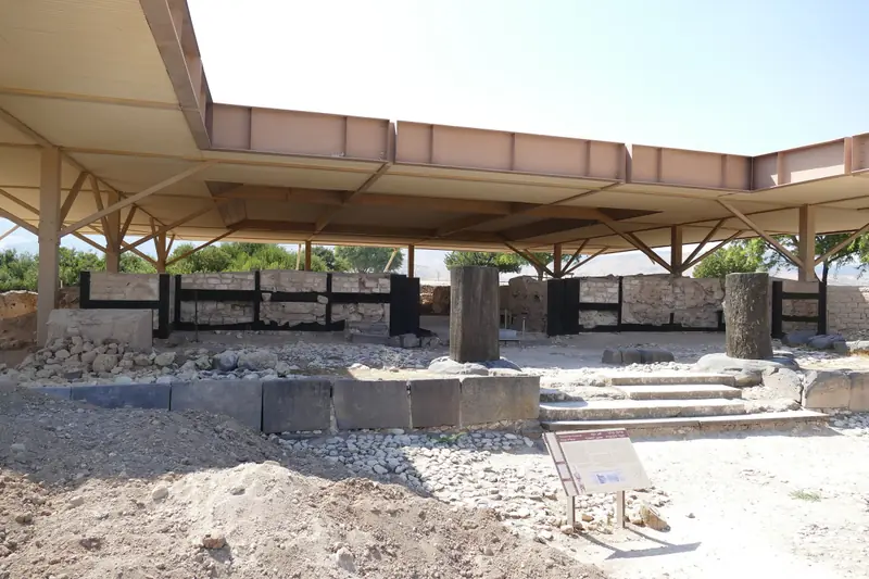
"The head of all those kingdoms": the largest Canaanite city in the land, its destruction by fire and an archaeological debate that is still open.
Tel Azekah lies in the Shephelah, above the Valley of Elah, in KKL-JNF's Britannia Park, about 8 km south-west of Beit Shemesh. GPS coordinates are in the "Getting there & GPS" section.
After the battle of Gibeon, Joshua pursues the five Amorite kings "to Azekah, and unto Makkedah", and great hailstones strike the fugitives as far as Azekah (Joshua 10:10-11). The text does not describe the capture of the town itself.
They show a Canaanite city destroyed by fire, with victims, in the second half of the 12th century BCE. This destruction is later than the dates proposed for Joshua and its cause remains unknown: it cannot be linked directly to the account.
According to 1 Samuel 17:1, the Philistines camp "between Socoh and Azekah", at the edge of the Valley of Elah, before David fights Goliath. The summit lookout bears verses from that chapter.
These are the closing words of Lachish Letter 4, an ostracon from the time of the Babylonian invasion (early 6th century BCE). It echoes Jeremiah 34:7, where Lachish and Azekah are the last fortified cities of Judah. Its exact meaning, the fall of Azekah or simply a problem of visibility, is debated.
The summit and lookout are freely accessible, but the excavation areas are not necessarily open or set up for visitors. During the summer season the expedition works on site: you can watch from a distance without entering the dig areas.
About 45 minutes to an hour. Tel Azekah combines easily with Khirbet Qeiyafa, Beit Guvrin or Tel Lachish on the same day.