
Tel Lachish: The Canaanite City Taken by Joshua
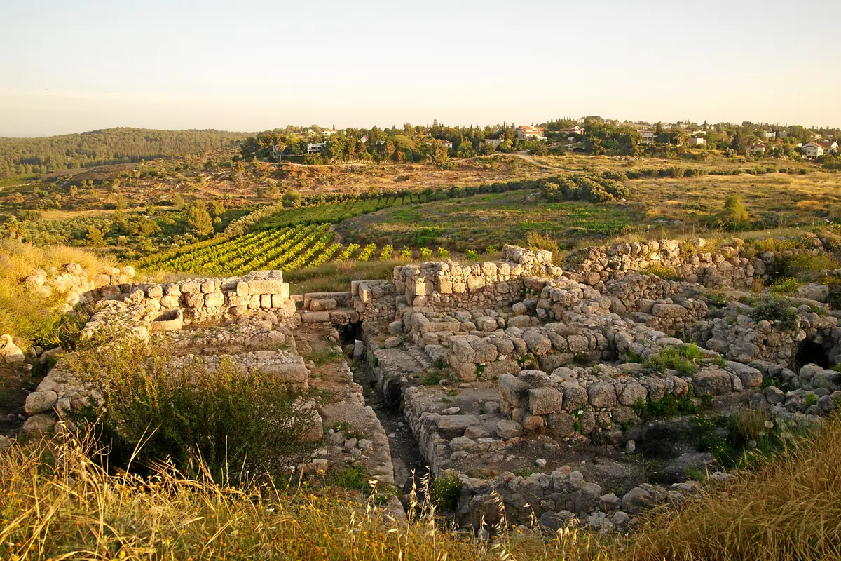
A royal Canaanite city under Egyptian rule, Lachish is one of the southern cities Joshua is said to have taken. Its excavations tell a more complex, and longer, story.
1500–1200 BCE
A powerful Canaanite city that the Book of Joshua says was never taken, named by the pharaohs of the Amarna age and by Merneptah, then rebuilt under Solomon.
Credit: Davidbena · CC0 · Wikimedia Commons
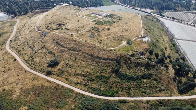
Halfway between Jerusalem and Tel Aviv, near the village of Karmei Yosef, Tel Gezer National Park covers a hill overlooking the Aijalon Valley and the coastal plain. In the Bible, Gezer appears in the conquest narrative: its king Horam is defeated by Joshua when he comes to the aid of Lachish, yet the Canaanites of the city are not driven out (Joshua 10:33; 16:10).
Tel Gezer is also one of the best-documented sites of the end of the Bronze Age: its kings write to Pharaoh in the Amarna letters, and around 1208 BC the Merneptah Stele claims that "Gezer is captured". On the ground you walk past a Canaanite gate, a high place with ten standing stones, an impressive rock-cut water system and an Iron Age six-chambered gate attributed to Solomon.
"Then Horam king of Gezer came up to help Lachish; and Joshua smote him and his people, until he had left him none remaining."
Joshua 10:33 (KJV)
״אָז עָלָה הֹרָם מֶלֶךְ גֶּזֶר לַעְזֹר אֶת־לָכִישׁ וַיַּכֵּהוּ יְהוֹשֻׁעַ וְאֶת־עַמּוֹ עַד־בִּלְתִּי הִשְׁאִיר־לוֹ שָׂרִיד.״
יהושע י, לג
Gezer enters the biblical story in Joshua 10, during the southern campaign. While the Israelites besiege Lachish, Horam, king of Gezer, marches to help the neighbouring city and is defeated. The text does not say that Gezer itself was taken: this is a battle fought against its king's army, far from its walls. The "king of Gezer" then appears in the list of defeated kings (Joshua 12:12).
The Books of Joshua and Judges stress a striking point: Gezer is not conquered. The city is allotted to the tribe of Ephraim, but its Canaanite inhabitants remain.
"And they drave not out the Canaanites that dwelt in Gezer: but the Canaanites dwell among the Ephraimites unto this day, and serve under tribute."
Joshua 16:10 (KJV)
״וְלֹא הוֹרִישׁוּ אֶת־הַכְּנַעֲנִי הַיּוֹשֵׁב בְּגָזֶר וַיֵּשֶׁב הַכְּנַעֲנִי בְּקֶרֶב אֶפְרַיִם עַד־הַיּוֹם הַזֶּה וַיְהִי לְמַס־עֹבֵד.״
יהושע טז, י
The Book of Judges repeats the observation almost word for word: "Neither did Ephraim drive out the Canaanites that dwelt in Gezer" (Judges 1:29). This account of an unfinished conquest contrasts with the image of a total takeover of the land. It matches what the Egyptian sources suggest: in the Late Bronze Age, Gezer remained a Canaanite city tied to Egypt.
In the division of the land, Gezer is listed among the cities given with their pasturelands to the Levites of the family of Kohath (Joshua 21:21). The verse names it right after Shechem, a city of refuge. On paper the city belongs to Israel's territory, yet the narrative admits that it stays in Canaanite hands.
According to the Bible, Gezer only passes to Israel much later, in the 10th century BC. A pharaoh, whom the text does not name, captures it, burns it and gives it as a dowry to his daughter, Solomon's wife. The king rebuilds it along with Jerusalem, Hazor and Megiddo.
"For Pharaoh king of Egypt had gone up, and taken Gezer, and burnt it with fire, and slain the Canaanites that dwelt in the city, and given it for a present unto his daughter, Solomon's wife."
1 Kings 9:16 (KJV)
״פַּרְעֹה מֶלֶךְ־מִצְרַיִם עָלָה וַיִּלְכֹּד אֶת־גֶּזֶר וַיִּשְׂרְפָהּ בָּאֵשׁ וְאֶת־הַכְּנַעֲנִי הַיֹּשֵׁב בָּעִיר הָרָג וַיִּתְּנָהּ שִׁלֻּחִים לְבִתּוֹ אֵשֶׁת שְׁלֹמֹה.״
מלכים א ט, טז
This epilogue lies beyond the period of the Exodus and the conquest, but it sheds light on the end of Gezer's Canaanite history. The biblical text is the only source that mentions this gift of the city.
Few cities of Canaan feature so often in the Egyptian records of the New Kingdom. These texts say nothing of Joshua or of Israelites at Gezer, but they show what the city was like at the time the biblical narrative places the conquest.
🔎 What these sources say
In the Late Bronze Age, Gezer appears as an important Canaanite city-state and a vassal of Egypt. This fits Joshua 16:10, which describes Canaanites remaining at Gezer. However, no Egyptian text mentions an Israelite attack on the city, and archaeology cannot date Horam's battle.
Gezer is one of the first biblical cities identified through inscriptions. From 1874 onward, Charles Clermont-Ganneau found stones around the mound engraved in Hebrew (or Aramaic) and Greek, reading "boundary of Gezer". They date to the last centuries BC. The mound was then excavated by R. A. S. Macalister for the Palestine Exploration Fund (1902-1905 and 1907-1909), and by William G. Dever and Hebrew Union College (1964-1973, with further seasons in 1984 and 1990). From 2006 to 2017, Steven Ortiz and Samuel Wolff directed the Tel Gezer Excavation and Publication Project, under the Tandy Institute for Archaeology and later the Lanier Center (Lipscomb University). Publication of their results is ongoing.
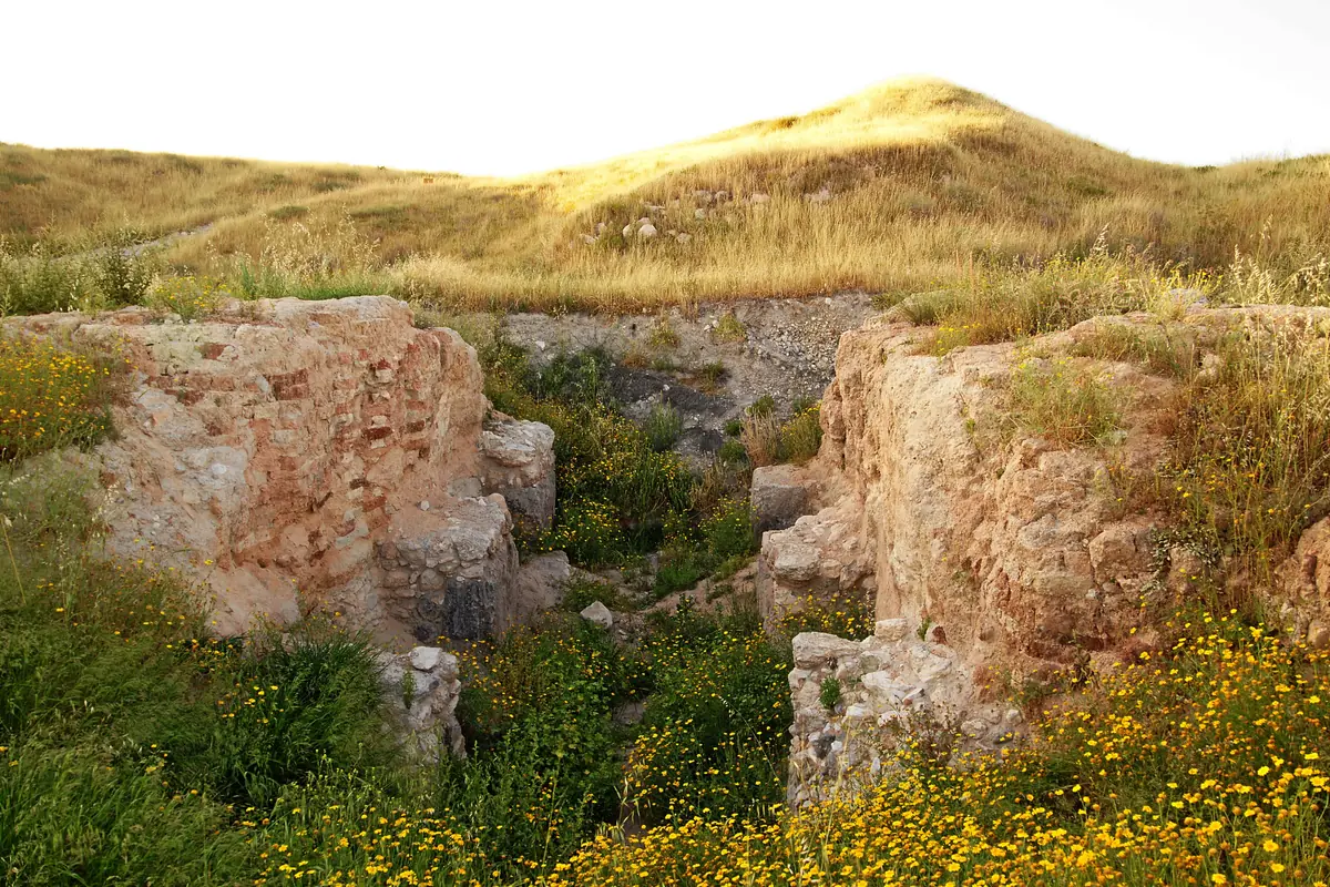
In the Middle Bronze Age, Gezer became a large fortified city. On the south-western slope, excavators uncovered a gate flanked by towers, with mudbrick walls on stone foundations. A massive tower protects it. An earthen rampart of packed chalk and soil, coated with plaster, reinforced the foot of the walls.
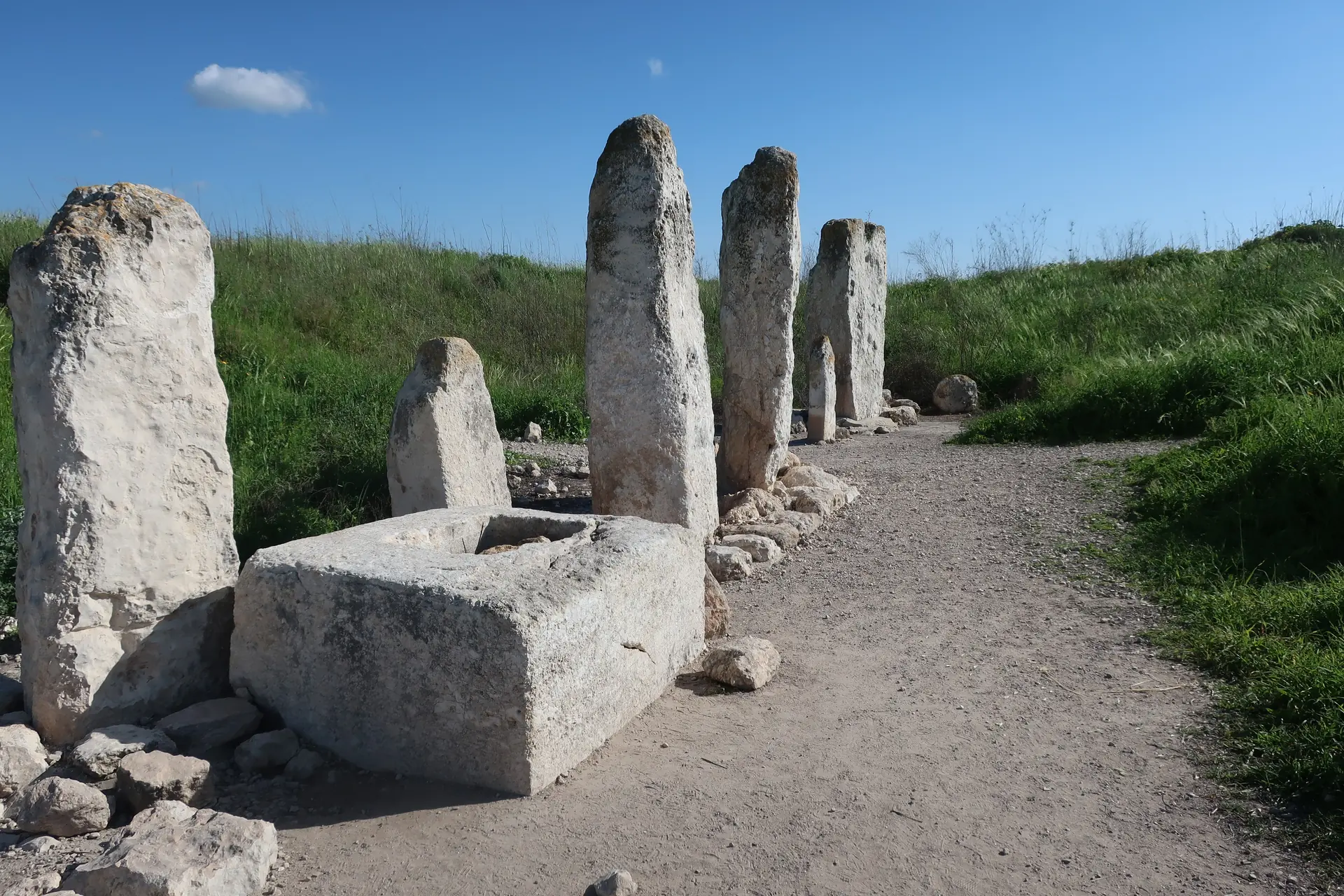
In the north of the mound stands the most spectacular monument of the site: a row of ten standing stones (masseboth) aligned north-south. The tallest is about three metres high. In front of them, a large stone basin may have been used for libations. Cleared by Macalister and re-examined in 1968, the complex is dated to around 1600 BC; its exact purpose is still debated. It is often seen as a Canaanite "high place", and sometimes as a monument marking alliances between cities.
⚠️ Mind the dates
The Gezer standing stones date to the Middle Bronze Age, around 1600 BC: they are earlier than 1500, and so older than the period in which the Exodus and the conquest are placed. They are neither a monument of Joshua nor a trace of the Israelites. They illustrate the Canaanite religion the Bible speaks of, for example when Deuteronomy 12:3 commands the Israelites to "break their pillars" (Hebrew matsevot, standing stones).
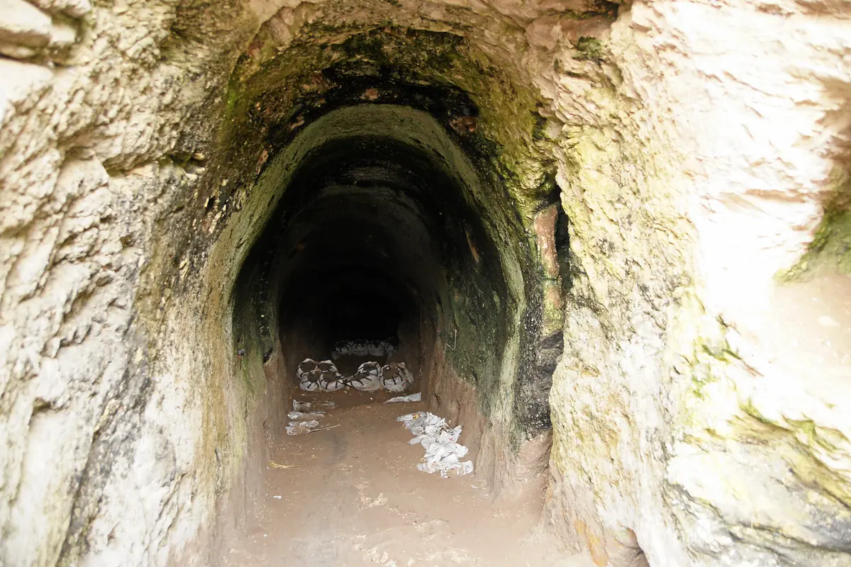
A sloping tunnel about sixty metres long, cut into the rock, runs down to the water table. It allowed the inhabitants to draw water from inside the city. First uncovered by Macalister, it was fully cleared between 2010 and 2017 by a team from the New Orleans Baptist Theological Seminary and the Parks Authority. Its excavators date it to the Middle Bronze Age, which would make it one of the oldest of its kind in the country. This dating is still debated.
The Late Bronze Age levels (c. 1550-1200 BC) are less conspicuous on the ground. They are nonetheless well documented: monumental buildings on the acropolis, Egyptian scarabs and seals, including a large scarab bearing the name of Amenhotep III. They illuminate the setting of the Amarna letters. Ortiz and Wolff's excavations exposed a large house burned at the end of the 13th century, in which lay the skeletons of three people. The excavators attribute this destruction to Merneptah's campaign. For other scholars, the link with the stele is possible but unproven.
On the southern slope, the so-called "Solomonic gate" has three pairs of guardrooms on either side of the passage. It connects to a casemate wall. Macalister took it for a Maccabean citadel. In 1957 Yigael Yadin compared it with the identical gates of Hazor and Megiddo and with 1 Kings 9:15. Recent excavators date it to the 10th century BC; supporters of a "low chronology" prefer the 9th century. Either way, it is several centuries later than the period of Joshua.
In 1908 Macalister found a small engraved limestone tablet: the Gezer Calendar. It lists the months according to farm work (olive harvest, sowing, barley harvest…). Usually dated to the 10th century BC, it is among the oldest known inscriptions of the region; specialists still debate whether its language is already Hebrew or a closely related Canaanite dialect. The original is kept in the Istanbul Archaeology Museums; an enlarged replica stands along the trail.
The route suggested by the Israel Nature and Parks Authority is a marked walking loop. From the car park, where traces of the first excavation camp survive, you pass the entrance to the mound. You then walk past the replica of the Gezer Calendar and the southern viewpoint towards Karmei Yosef.
🧭 What you see, and from which period
Gate, tower, standing stones and water system: Middle Bronze Age, before 1500 BC. Late Bronze Age levels: hardly visible, known mainly from excavation and finds. Six-chambered gate: Iron Age, 10th-9th century BC. No remains can be linked directly to Horam or Joshua.
Gezer pairs well with the other Shephelah cities mentioned in Joshua 10, such as Lachish and Azekah. For the wider context, see the period of the Exodus and the conquest of Canaan.
Tel Gezer: The Canaanite City from Joshua to Solomon
Tel Gezer National Park, reached from Route 44 near Karmei Yosef (between Ramla and Beit Shemesh)
GPS coordinates : 31.8597, 34.9225
Start navigation with:
A royal Canaanite city under Egyptian rule, Lachish is one of the southern cities Joshua is said to have taken. Its excavations tell a more complex, and longer, story.
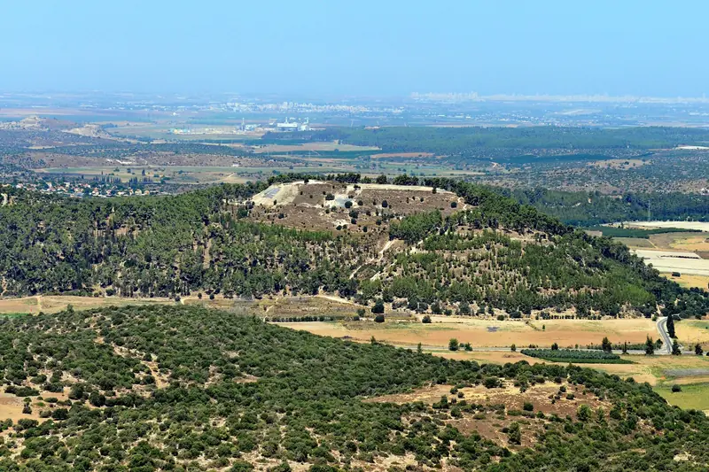
On a wooded hill commanding the Valley of Elah, Azekah marks the end of the pursuit of the Amorite kings. Excavations there have revealed a Canaanite city destroyed by fire.
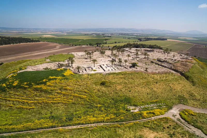
A Canaanite city the Bible says was defeated but never dispossessed: four thousand years of history at the crossroads of Egypt and Mesopotamia.
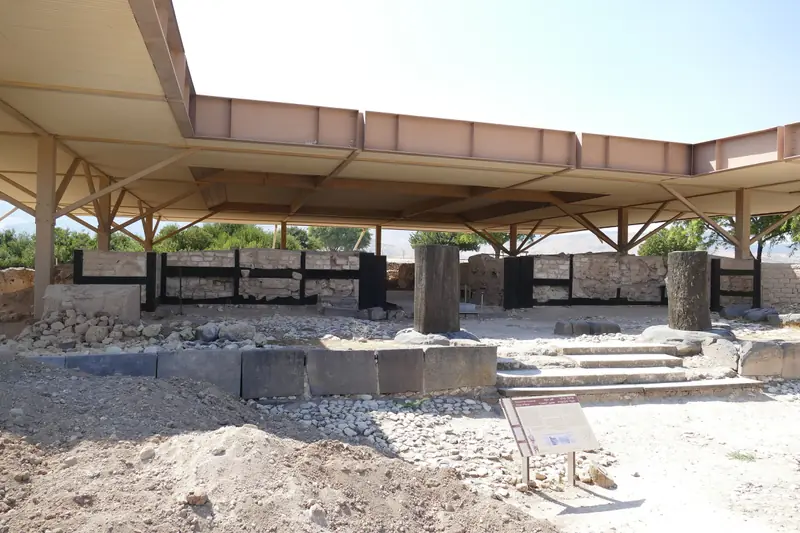
"The head of all those kingdoms": the largest Canaanite city in the land, its destruction by fire and an archaeological debate that is still open.
Tel Gezer lies in the Shephelah, halfway between Jerusalem and Tel Aviv, near Karmei Yosef. It is reached from Route 44 and then a marked farm track. GPS coordinates and Waze, Google Maps and Apple Maps links are in the "Access & GPS" section.
According to the Israel Nature and Parks Authority, the site is open with no set hours and no entrance fee (checked on 29 September 2026). Staying overnight is forbidden. These conditions may change: check with the park authority before you go.
No, according to the Bible itself. Joshua defeats Horam, king of Gezer, who came to help Lachish (Joshua 10:33), but the text states that the Canaanites of Gezer were not driven out (Joshua 16:10; Judges 1:29). The city only becomes Israelite in Solomon's time (1 Kings 9:16-17).
No. The high place with ten standing stones dates to the Middle Bronze Age, around 1600 BC, that is before 1500. It predates the period of the Exodus and the conquest. It is a Canaanite monument whose exact purpose is still debated.
This inscription of Pharaoh Merneptah, dated around 1208 BC, states that Gezer was captured during his campaign in Canaan. It also mentions "Israel", the oldest known occurrence of the name. Recent excavators link a fire at the end of the 13th century to this campaign.
The original, discovered in 1908, is kept in the Istanbul Archaeology Museums. An enlarged replica is displayed along the national park trail.
Yes, about 175 steps lead to the bottom of the tunnel. It gets dark after a few dozen steps: bring a torch and suitable shoes, and watch out for the slippery floor. Dogs are not allowed inside.
The other cities of Joshua 10 in the Shephelah, such as Tel Azekah and Tel Lachish, or Megiddo and Hazor, which have comparable six-chambered gates.